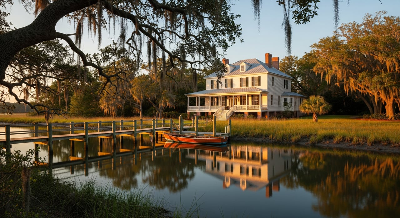
You picture sunrise over glassy water, the call of shorebirds, and a quick boat ride before lunch. That vision is real in Historic Georgetown, but the details matter. Tides, channels, and dock rules shape how you live day to day on the Sampit River and Winyah Bay. In this guide, you’ll learn what each type of waterfront offers, how boating works here, and the permits and maintenance that come with the view. Let’s dive in.
Waterfront types in Historic Georgetown
Riverfront along the Sampit
Riverfront homes sit on the Sampit River or its tidal creeks. You get classic inland-water views, often with potential for private piers. Depth can vary with tide and location, so larger boats may need access to deeper channels. Older homes may have bulkheaded shorelines, while newer builds often use modern floating dock designs.
Harborfront near Winyah Bay
Harborfront or working waterfront properties are closer to the river mouth and navigation channels. These areas tend to support larger vessels and have more active boating traffic. You are near marinas and services that support fueling, haul-out, and repair. Expect a livelier backdrop with commercial and recreational boats.
Marsh‑view and marsh‑edge
Marshfront homes look over tidal salt marsh, with the sweeping Lowcountry scenery many buyers love. These lots may not have deep water at the shoreline. Boat access could require a longer pier into a tidal creek or regular use of a nearby public ramp or marina. Wildlife viewing is excellent, and you will notice the natural rhythms of the tide.
ICW‑adjacent
Some properties sit on or near the Intracoastal Waterway. ICW proximity can make coastal cruising simpler, but private deepwater access still depends on shoreline shape and local depths. Shoaling patterns change over time, so verify navigation conditions before you plan for a larger vessel at a private dock.
Daily life: tides, ecology, and weather
Tides set the rhythm
Georgetown’s waters follow a semi‑diurnal pattern, with two high tides and two low tides about every 24 hours and 50 minutes. Tidal range shifts with monthly and seasonal cycles. That affects when you launch, whether a shallow creek is passable, and how your dock is built. Visiting a property at both high and low tide gives you a true picture of access.
Salinity and the marsh
You live in a dynamic estuary where salinity changes with rain and tidal exchange. The mix of brackish to marine water supports fish, shrimp, and blue crab. It also affects marine growth on hulls and the best hardware for docks and lifts. Marsh plants help buffer waves and surge, though some edges can naturally erode over time.
Storm surge and flood awareness
This coast sees tropical systems and nor’easters. Surge can push water well above normal levels and overtop low docks and yards. Flood zones, local rules, and elevation all influence how you insure and maintain a waterfront home. If the property sits in a historic district, some exterior changes may require preservation review.
Sediment and shoaling
Channels and tidal creeks can shift. Over months or years, a once‑deep spot may shoal and limit access at lower tides. Keeping a private channel open can require permits and dredging, which is specialized and often costly. Factor this into your long‑term plan if you want consistent deepwater access.
Boating and access basics
Match your boat to the water
- Shallow‑draft boats: Skiffs, jon boats, and many bay boats do well in marsh creeks, especially near mid to high tide.
- Moderate‑draft family boats: Many Sampit River locations support these at most tides, though low water can limit access in smaller creeks.
- Larger, deeper‑draft vessels: Trawlers, cruisers, and sportfishers need maintained channels and marina‑grade slips. Harborfront or ICW slips are best for consistency.
Getting to Winyah Bay and beyond
From the Sampit, you reach Winyah Bay and onward to the Atlantic or continue on the ICW. Depths and markers evolve with sediment patterns, so plan passages with current charts and local notices. Many newcomers hire a local captain for a few runs to learn the channels.
Marinas and ramps
Even if you have a dock, you may rely on marinas for fuel, shore power, haul‑out, and repair. Marshfront owners often launch at public ramps and store larger boats at marinas. This blend of private access and marina services is common across Georgetown.
Time your trips
Tide windows matter. In shallow creeks, a low‑tide launch can strand you until the water returns. Build a simple routine around the daily tide cycle so you are set up for smooth outings and safe returns.
Docks, permits, and upkeep
Dock types that work here
- Fixed piers: Solid and simple, best where tidal swing is manageable and pilings can be set to account for surge.
- Floating docks: Rise and fall with the tide, which keeps boarding safer and easier.
- Boat lifts: Protect smaller vessels from growth and wave action. Choose capacity and orientation with wind and exposure in mind.
- Moorings or community slips: Good solutions where a private pier is impractical or restricted.
Permits and reviews to expect
Waterfront construction is a process. You will likely coordinate with the Town of Georgetown or Georgetown County for building approvals. In South Carolina, coastal work often requires review by the Office of Ocean & Coastal Resource Management and may also involve the U.S. Army Corps of Engineers. Water‑quality certification can apply. If your property sits in a historic area, design review may apply for visible shoreline changes. Always confirm riparian rights, setbacks, and any community covenants before you plan a new dock.
Maintenance in a salt environment
Salt, sun, and storms raise upkeep needs compared to freshwater. Expect periodic inspection of pilings, fasteners, and floats, plus cleaning marine growth and replacing worn decking. Materials matter. Treated lumber, composites, and marine‑grade metals each have tradeoffs in cost and longevity. If you rely on dredged access, build a budget and schedule for periodic surveys and permits.
Insurance and budgeting
Waterfront typically means flood coverage and careful attention to wind and storm provisions. Elevation, construction details, and local codes influence premiums. Dock construction and repair costs vary with length, exposure, and materials. A smart approach is to budget for annual maintenance plus a reserve for major repairs after significant storms.
Which waterfront fits your lifestyle?
- Marsh‑view: You value scenery, birds, and quiet, and plan to run a shallow‑draft skiff or use a nearby marina. You accept tidal dynamics and natural marsh odors in warm months.
- Riverfront upriver: You want regular boating with scenic views and room for a private pier, depending on depth. It is a balanced option for many families.
- Harborfront or deepwater: You run a larger vessel, cruise often, or want fast access to marinas. Expect more boat traffic and an active waterfront scene.
- ICW‑adjacent: You are a cruiser at heart and prize simple passage along the coast. You will still verify local depths before counting on a private deepwater dock.
Buyer checklist and next steps
Key questions to ask at showings
- What type of waterfront is this, and where are the riparian boundaries?
- What is the depth at mean low water at the shoreline and the dock? Is there a recent survey?
- Is the dock permitted? Are there as‑built drawings and maintenance records?
- Do historic‑district rules, covenants, or easements affect docks or shoreline work?
- What is the recent history of shoaling or dredging nearby? Any current notices?
- Which FEMA flood zone applies? What are typical flood insurance costs and requirements?
- Which marinas, ramps, haul‑out, and repair options are nearby? Are there storage options?
- For marshfront lots, is boat access practical at common tides, or will a marina be your plan?
- Are erosion or stabilization projects planned in the immediate area?
Practical steps before you buy
- Visit the property at both high and low tide.
- Request depth data and consider hiring a marine surveyor.
- Obtain copies of dock permits and verify with local and state agencies.
- Review flood maps and collect current insurance quotes.
- Speak with marinas and boatyards about services and seasonal capacity.
- Consult a coastal engineer or marine contractor on shoreline stability, dock feasibility, and likely maintenance.
- If applicable, confirm historic‑district design review for shoreline changes.
Plan with a trusted local guide
Waterfront living in Historic Georgetown rewards you with scenery, wildlife, and access to Lowcountry waters. It also asks you to plan for tides, permits, and maintenance. With the right preparation and a clear match between your boat, your dock, and your shoreline, you can enjoy an easy rhythm on the Sampit and Winyah Bay. If you are weighing marsh‑view serenity against deepwater convenience, trusted local guidance makes all the difference.
For a tailored game plan and property shortlist that fits your lifestyle, connect with Mariah Johnson. Request a personalized consultation and move forward with confidence.
FAQs
What “deepwater” means for Georgetown buyers
- In local use, deepwater typically means consistent depth at lower tides that can accommodate larger boats without grounding. Always verify depth at mean low water along the shoreline and any dock.
How tides affect daily boat access on marsh creeks
- Shallow creeks can be passable at mid to high tide but limit access at low tide. Plan outings around the daily high‑water window so you do not get stranded.
Insurance needs for waterfront homes in Historic Georgetown
- Expect to evaluate flood coverage, wind and storm provisions, and any requirements tied to your FEMA flood zone and construction details. Premiums depend on elevation and mitigation features.
Building a new dock on a marshfront lot in the historic area
- It is a multi‑agency process. Confirm riparian rights and setbacks, then coordinate with Town or County permits, state coastal management, and often the U.S. Army Corps of Engineers. Historic‑district review may also apply.
Using the ICW and reaching open water from Georgetown
- You can access Winyah Bay and the Atlantic or cruise the ICW, but depths and markers change with shoaling. Check current charts and local notices and consider a run with a local captain to learn the route.